Way back in 2006, Patrick and crew developed a really cool pilot project for automatically adding
geotagged photographs to a
GeoPDF. The idea was to have someone in the field drive around and take photographs of any target area with a
Ricoh Digital Camera. These cameras have a built in GPS which allows for automatic
geotagging. You are also able to take it to the next level by using the camera to record an audio clip. Pretty cool indeed!!! Here is the workflow:
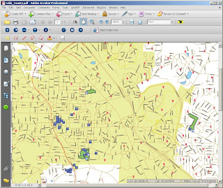
1. Create a base map to work with. This can be anything from a high resolution image to a simple vector layer that is exported to
GeoPDF.
2. Select the directory full of geotagged images. Note that future releases of this application will allow the user to ingest geotagged images from Google Maps and Flickr.
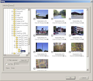
3. Select all the photos you would like to add then click the OK button. This will load all your photos in to the
GeoPDF and maintain the spatial integrity of the data.
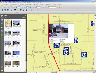
4. You will now see that each photo is adding to both the map space as well as a
separate page in the table of contents. You can browse to each image by selecting it in the map or by clicking on it in the table of contents.
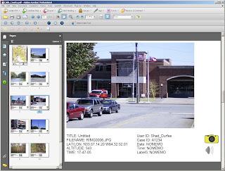
5. To hear the audio clip, select the speaker icon and to return to the map and select the camera icon. It's that easy!
To download this
data set click here...
Labels: Flickr, Geotagging, Google, Ricoh
 The official Google Blog announced yesterday that their browser, Google Chrome, is now officially out of beta! I downloaded this version and must say that it is quit fast although I can't really recall how much faster it is as compared to the beta program version. At any rate, less is more and this browser is definitely the "no frills" speedster I use every day! Happy browsing everyone...


